
Arctic Navigation and ION GNSS

The once inaccessible Arctic Ocean has gained economic attention as a result of the recession of the Arctic sea ice. This has triggered the expansion of many industries in the Arctic, some prospective and others very real and rapidly expanding.
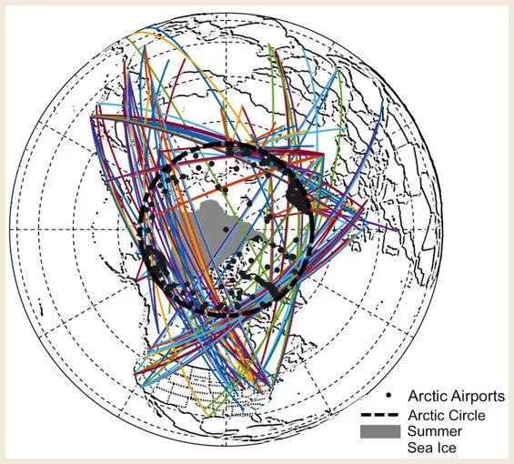
This growing activity, along with the harsh environment and remote reaches of the Arctic, necessitates the highest levels of safety. Our approach to navigation safety is multi-tiered: first is improved ship sensing technology. Our work has focused on combining multiple sensors to improve local situational awareness. Next is improved global situational awareness through ship-to-ship information sharing and surveillance by satellite and UAS. This allows ships to perform path planning of their routes to minimize risk through ice. Last is navigation integrity. Knowledge of exactly where you are is critical in making sense of the flood of ice and ship traffic information. This can be achieved using GNSS in conjunction with SBAS and ARAIM. This last piece also enables aircraft precision approach, allowing for a safe landing at any of the large number of airports in the Arctic Circle.
For More Information
- View PDF presentation: GNSS Integrity in the Arctic , by Tyler Reid, Todd Walter, Juan Blanch and Per Enge, Stanford University GPS Research Lab. ION GNSS+ 2015, September 17, 2015, Tampa, FL.
- View PDF paper: Using Traffic Information Services Broadcast (TIS-B) Signals for Aviation Navigation , by Sherman Lo, Yu Hsuan Chen, Andrew Barrows, Adrien Perkins, Tyler Reid and Per Enge, Stanford University; Shau Shiun Jan, National Cheng Kung University.
Animations and Video

View animation: Summer Arctic Sea Ice Extent 1980–2012 , by Tyler Reid.

View video clip: December 2014 In-Flight Test of Radar-Produced Positions from the Ground , by Tyler Reid.

View animation video: Route Animation from December 2014 In-Flight Test of Radar-Produced Positions from the Ground , by Tyler Reid.